Strawberry Bay Falls was on the agenda for the day. After having to stop in Sequim for some supplies, then spending some time in Forks, WA to see the “Twilight” scenes, we were running a little late.
We had originally intended to travel all the way around to Lake Quinault and visit about 4 waterfalls near there. That part of the trip would have to be held off for another time.
We found the Third Beach trailhead by following our GPS instructions which took us from Highway 101 and onto Highway 110 at Forks, WA. We arrived at the trailhead about 2 miles before La Push. Come to think about it, we never actually ventured on into La Push on this trip. Oh well, something else for another day.
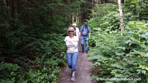
The hike from the trailhead to the beach is about 1 1/4 miles. It was obvious to me that Leslie was wishing she had brought her jacket. I was wearing a t-shirt and shorts and felt very comfortable.
We made sure that dad and mom didn’t feel like they had to complete every trek that Leslie and I were on, but they were determined to reach the destination.
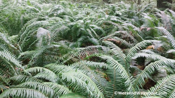
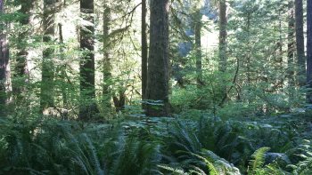
The scenery along the trail was mostly very green – we were in a rainforest, after all.
Most of the trail was pretty smooth and level, but shortly before we came to the ocean, we began to descent down toward the beach and the trail got a little rugged with rocks and protruding roots.
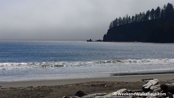
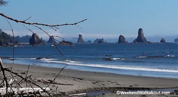
We enjoyed a short walk of about 1/2 mile along a smooth, sandy beach. The weather was very pleasant. A friend of ours who was at First Beach the day after we were here said it was raining so hard, they didn’t get out of the car. I guess we were lucky.
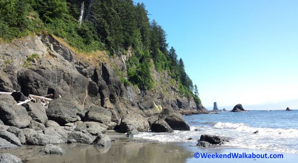
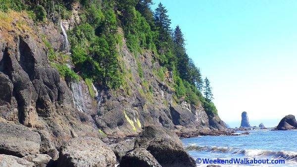
The waterfall, itself, is rather unimpressive, however, it is unique and interesting as it drops off a cliff and into the ocean. It’s the first ocean falls that I’ve been to. In fact, I don’t think I’ve ever seen a waterfall that drops into any significant body of water.
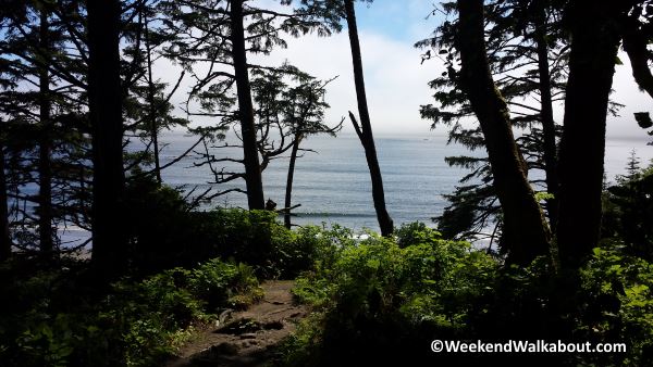
I think what made this waterfall visit the most interesting was the diversity of landscape through the short hike to the waterfall. I really enjoyed the hike through a rainforest, descending down onto an ocean beach. Who doesn’t like a walk along the beach on a calm day?
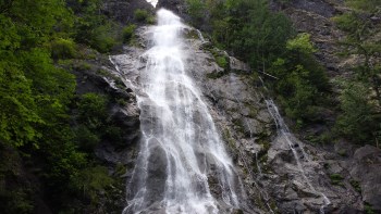
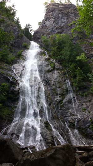
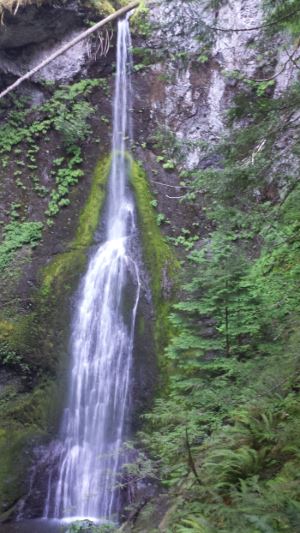 The last waterfall we visited while on our trip to Discovery Bay was Marymere Falls. It’s located in Clallum County in the north central part of the peninsula just to the south of Crescent Lake and about 20 miles west of Port Angeles. The trail head is next to the Storm King Ranger Station.
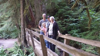 Along the way, the trail splits into a loop that will take you to two different view points for the waterfall. If you take the left fork, you will first enjoy the lower view point which is directly across from the base of the falls and looking up to the top. The upper view point provides you with a vantage point that is near the center-top of the 100 plus foot waterfall.
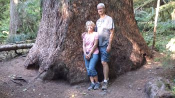 My mom and dad, who are in their late 70’s/early 80’s were traveling with us and were able to make the hike all the way to the lower viewing area. They elected not to continue the climb to the upper viewing area. Because the last part of the hike was mostly uphill with lots of stairs, I wasn’t sure that they would continue all the way in to where they could see the falls, but they were troopers – very tired troopers, but they made it.
 I can’t begin to describe the feelings and enjoyment that I get from experiencing the beauty of the outdoors that God created for us. All I can say is that the experience is well worth the short distance to travel and the easy walk to these falls.
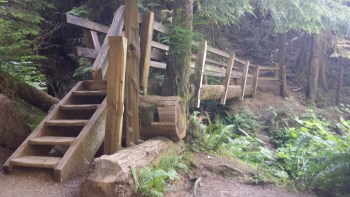
 After leaving
 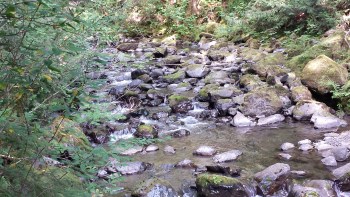 It was a short, easy walk along a well groomed trail to get to the falls. We especially hoped to find waterfalls like this that were easily accessible for my parents who were with us on this trip. They get around pretty well, but long and rugged trails would definitely hold them back.
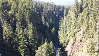
 While traveling to Discovery Bay with my Parents, we decided to check on a couple waterfalls that were along the way. There were four of them between Shelton and Port Townsend that we had identified and we had hoped to visit at least 2 or 3 of them. I hadn’t done a significant amount of research on any of these falls, but I had downloaded a brochure from olympicpeninsulawaterfalltrail.com before we left on the trip.
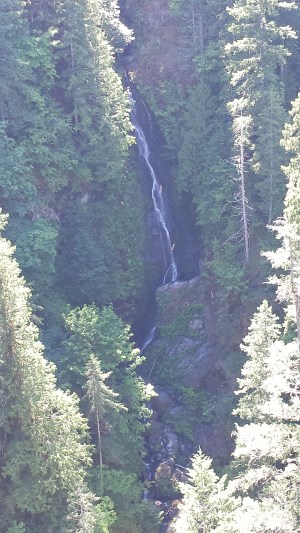
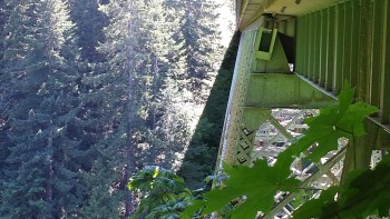 The High Steel Bridge spans across a deep but narrow Skokomish River valley. From the bridge, you can see the river about 420 feet below. After walking about half way across the bridge, I looked back over my left shoulder and saw the narrow Vincent Creek Falls dropping about 125 feet over the side of the chasm and then winds down into the Skokomish River.